Create GIS database in PostgreSQL

1. Install PostgreSQL database (for example 9.6)

2. Install postgis module (for example 2.5.1)

3. Start pgAdmin 4

4. Create database

5. Enable GIS features in database with following command:
CREATE EXTENSION postgis;

6. Now shapefile can be loaded with PostGIS 2.0 shapefile tool

7. Set GEO input format (for example Rijksdriehoek)
SELECT UpdateGeometrySRID(‘wegvakken’,’geom’, 28992);

8. Create WGS84 geog column and fill it.
ALTER TABLE wegvakken ADD COLUMN geog geography(geometry);
UPDATE wegvakken SET geog = ST_Transform(geom, 4326);
CREATE INDEX wegvakken_geog_idx ON wegvakken USING GIST (geog);

9. Now pgAdmin4 can show GEO layer with OpenStreetMap layer as base.

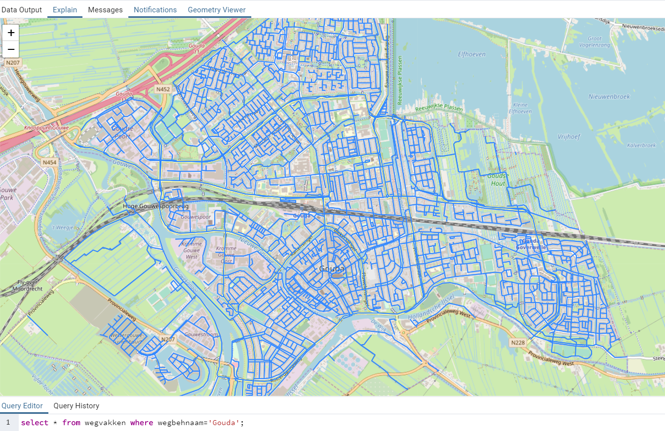
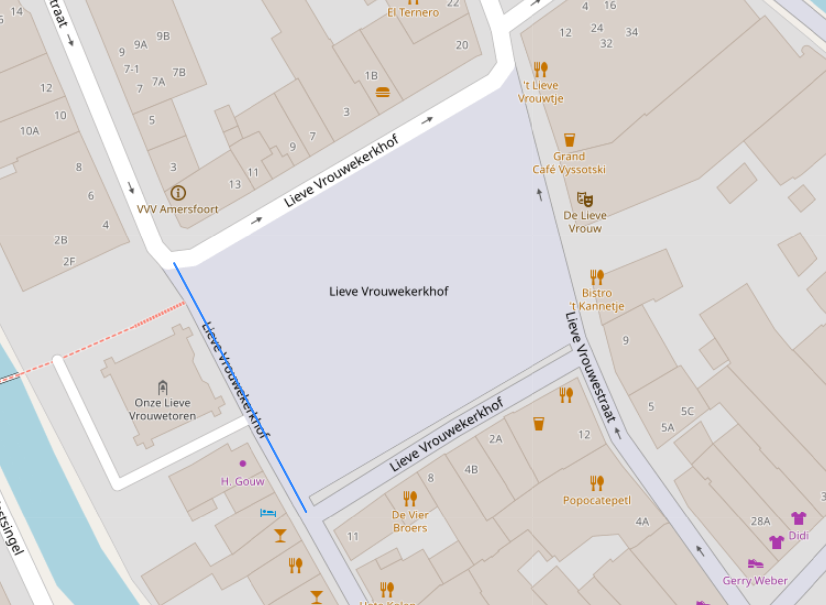
10. Set center point of RijksDriehoek (Onze Lieve Vrouwetoren (‘Lange Jan’) in Amersfoort.)
SELECT * FROM wegvakken ORDER BY geom <-> ‘SRID=28992;POINT(155000 463000)’::geometry LIMIT 1;

11. select ST_X(geom), ST_Y(geom) from shapefile

WAMP + PostgreSQL integration

If you want to extend an existing Windows WAMP installation with a PostgreSQL database execute the following steps:

Apache 2.2.X configuration
Add the next line to the Apache 2.2.x httpd.conf configuration:
LoadFile “C:/Program Files/PostgreSQL/9.1/bin/libpq.dll”

Above line must be entered before the next line.
LoadModule php5_module “c:/wamp/bin/php/php5.2.11/php5apache2_2.dll”

PHP 5.2.X Configuration
Enable (remove trailing ; character) the following two lines in the php.ini configuration file.
extension=php_pdo_pgsql.dll
extension=php_pgsql.dll

Restart WAMP
Restart the wamp (apache, php and mysql) software.

Test
Create the following test.php file and place it in the apache www root directory:

<?php
echo extension_loaded('pgsql') ? 'yes':'no';
?>

When the php file is executed (http://127.0.0.1/test.php) in apache the following information must be showed on screen.

yes